Skip to content

Randrita/Ship-Identification-and-Tracking-via-Satellite-Imagery

Folders and files

NameName
Last commit message
Last commit date

Latest commit


History

4 Commits


Repository files navigation

Ship Identification and Tracking via Satellite Imagery

WHY SHIP IDENTIFICATION?

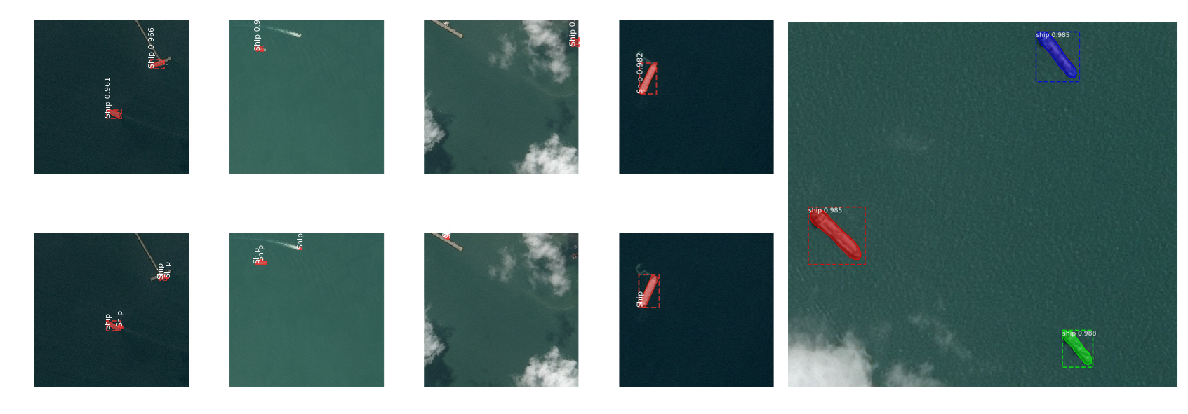
  • Ship detection is important for marine security.
  • This is done through the use of an Automated Identification System (AIS).
  • AIS uses VHF radio frequencies.
  • It fails to detect those ships  those which disconnect their VHF transponder.
  • This is where satellite imagery and image processing come to rescue.

A QUICK LOOK AT IMAGES WITH LABELS?

image

REQUIREMENTS

image

APPROACH

image

RESULT ANALYSIS WITH ANN

image

RESULT ANALYSIS WITH CNN

image

RESULT ANALYSIS WITH CNN AND DATA AUGUMENTATION

image

MASK RCNN

image

About

No description, website, or topics provided.

Resources

Stars

Watchers

Forks

Releases

No releases published

Packages

No packages published